Lower Big Blue Natural Resources District
Menu
  • External link opens in new tab or window Link Icon Link Icon Link Icon Programs
    • Link Icon Link Icon Link Icon Well Permitting
    • Link Icon Link Icon Link Icon Moisture Sensors
    • Link Icon Link Icon Link Icon Chemigation
    • Link Icon Link Icon Link Icon Tree Planting
    • Link Icon Link Icon Link Icon Flood Control
    • Link Icon Link Icon Link Icon Rural Water
    • Link Icon Link Icon Link Icon Education Resources
  • External link opens in new tab or window Link Icon Link Icon Link Icon Groundwater
    • Link Icon Link Icon Link Icon Recreation
      • Link Icon Link Icon Link Icon Bear Lake W.M.A.
      • Link Icon Link Icon Link Icon Big Indian Rec Area
      • Link Icon Link Icon Link Icon Clatonia Public Use Area
      • Link Icon Link Icon Link Icon Cub Creek Rec Area
      • Link Icon Link Icon Link Icon Green Top W.M.A.
      • Link Icon Link Icon Link Icon Leisure Lake W.M.A.
      • Link Icon Link Icon Link Icon Swanton W.M.A. (Swan 67)
      • Link Icon Link Icon Link Icon Walnut Public Use Area
      • Link Icon Link Icon Link Icon Willard Meyer Rec Area (Swan Lake)
      • Link Icon Link Icon Link Icon Wolf-Wildcat W.M.A.
    • Link Icon Link Icon Link Icon Cost-Share
      • Link Icon Link Icon Link Icon Forms
        • External link opens in new tab or window Link Icon Link Icon Link Icon Payments
          • Link Icon Link Icon Link Icon About Us/Contact
            • Link Icon Link Icon Link Icon Board of Directors
            • Link Icon Link Icon Link Icon Staff

          Green Top W.M.A.

          Green Top W.M.A.

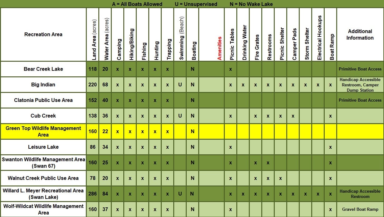
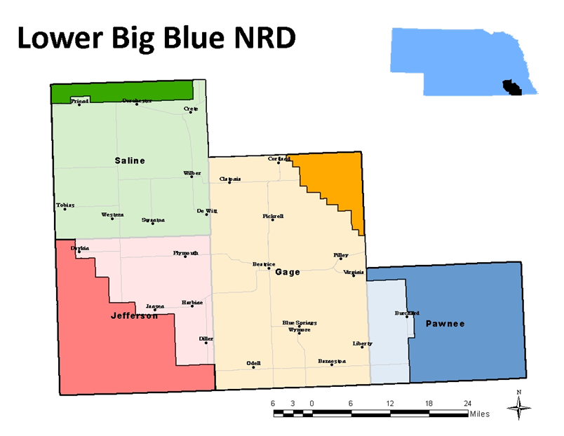
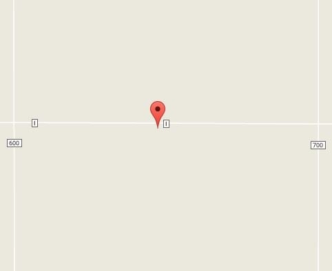
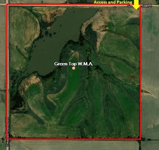
          Green Top Wildlife Management Area is named after the Green Top Diner in Friend, Nebraska.  The diner, known for its iconic green roof, was the popular place to stop for those traveling on the interstate, which is now Highway 6, through Nebraska in the 1940s.  The stop featured the diner, a repair shop, and gas station.  Encompassing the tail waters of Turkey Creek Dam Site #9, the area is made up of 160 acres of native grasses, trees and shrubs in the northwest quarter of section 13, township 7 north, range 1 east in Saline County, Nebraska (5 miles south of Friend, at the corner of County Roads 600 and I).  More specifically, the area contains 138 acres of land and 22 acres of surface water.  This area is a designated Wildlife Management Area, and as such is open to public access for hunting, fishing, trapping and hiking.


          Location

          Rule & RegsRule & Regs

          Directory Map


          Activities and Amenities

          Address

          805 Dorsey ST, PO Box 826 Beatrice, NE 68310

          P:(402)-228-3402

          F:(402)-223-4441

          lbbnrd@lbbnrd.net


          Contact US
          Invalid Form properties detected

          Your Name


          Your Email


          Message


          Subscribe to our E-Newsletter

          External link opens in new tab or windowClick to SubscribeClick to Subscribe

          Upcoming Events

          -April 13 - Monthly Board of Directors Meeting, 7:00PM @ NRD Office


          Click Here for Board Meeting Agenda and Minutes.


          Copyright 2023 Lower Big Blue Natural Resources District


            close lightbox