Lower Big Blue Natural Resources District
Menu
  • External link opens in new tab or window Link Icon Link Icon Link Icon Programs
    • Link Icon Link Icon Link Icon Well Permitting
    • Link Icon Link Icon Link Icon Moisture Sensors
    • Link Icon Link Icon Link Icon Chemigation
    • Link Icon Link Icon Link Icon Tree Planting
    • Link Icon Link Icon Link Icon Flood Control
    • Link Icon Link Icon Link Icon Rural Water
    • Link Icon Link Icon Link Icon Education Resources
  • External link opens in new tab or window Link Icon Link Icon Link Icon Groundwater
    • Link Icon Link Icon Link Icon Recreation
      • Link Icon Link Icon Link Icon Bear Lake W.M.A.
      • Link Icon Link Icon Link Icon Big Indian Rec Area
      • Link Icon Link Icon Link Icon Clatonia Public Use Area
      • Link Icon Link Icon Link Icon Cub Creek Rec Area
      • Link Icon Link Icon Link Icon Green Top W.M.A.
      • Link Icon Link Icon Link Icon Leisure Lake W.M.A.
      • Link Icon Link Icon Link Icon Swanton W.M.A. (Swan 67)
      • Link Icon Link Icon Link Icon Walnut Public Use Area
      • Link Icon Link Icon Link Icon Willard Meyer Rec Area (Swan Lake)
      • Link Icon Link Icon Link Icon Wolf-Wildcat W.M.A.
    • Link Icon Link Icon Link Icon Cost-Share
      • Link Icon Link Icon Link Icon Forms
        • External link opens in new tab or window Link Icon Link Icon Link Icon Payments
          • Link Icon Link Icon Link Icon About Us/Contact
            • Link Icon Link Icon Link Icon Board of Directors
            • Link Icon Link Icon Link Icon Staff

          Rural Water

          The Lower Big Blue NRD operates two rural water lines.  The first project was the Beatrice West rural water line completed in 2000.  As the name implies, this line is served by the City of Beatrice and runs west along Highway 4.  It serves approximately 40 users north and south of the highway including Pioneer Acres and the Homestead National Monument.

          The second project is the Wymore/Holmesville rural water line.  Construction on this project began in 2012 and was completed in 2013.  This line is served by the City of Wymore and runs north as far as Highway 136 and south to the state line.  From the west this line serves users from Odell going east to Liberty.  In total, there is approximately 170 miles of pipe serving 220 users.
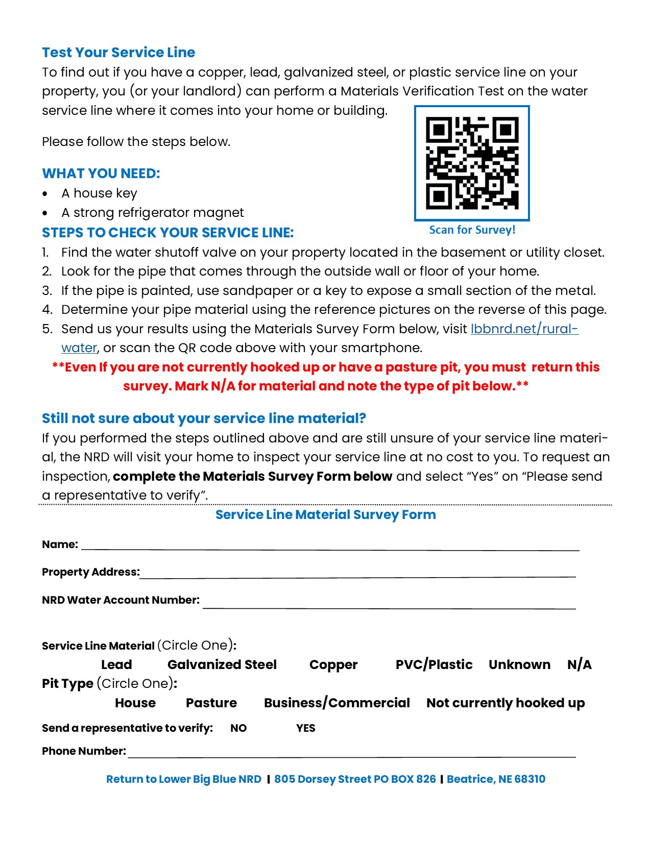
          Wymore/Holmesville

          External link opens in new tab or windowHow to Read Your MeterHow to Read Your Meter

          Wymore Rate Schedule

          Beatrice West

          Beatrice West Rate Schedule

          Payment Information

          -  Payment is due the 5th day of each month

          -  A 10% late fee will be assessed if payment is not received by the 15th

          -  Write your account number on the check memo line

          - Credit cards are accepted and payments can be made online from the "PAYMENTS" tab above.

          -  If you are selling property be sure to have the new owners complete and sign a new user agreement prior to closing


          Address

          805 Dorsey ST, PO Box 826 Beatrice, NE 68310

          P:(402)-228-3402

          F:(402)-223-4441

          lbbnrd@lbbnrd.net


          Contact US
          Invalid Form properties detected

          Your Name


          Your Email


          Message


          Subscribe to our E-Newsletter

          External link opens in new tab or windowClick to SubscribeClick to Subscribe

          Upcoming Events

          -April 13 - Monthly Board of Directors Meeting, 7:00PM @ NRD Office


          Click Here for Board Meeting Agenda and Minutes.


          Copyright 2023 Lower Big Blue Natural Resources District


            close lightbox