| |
News and Information
| |
Pursuant to Neb. Rev. Stat. § 46-743, the Lower Big Blue Natural Resources District (NRD) hereby provides notice that the Lower Big Blue NRD shall hold a public hearing on Wednesday November 6, 2024, at 6:00 p.m. in the 4-H Building located at the Gage County Fairgrounds, 1115 West Scott Street, Beatrice Nebraska. As required by Neb. Rev. Stat. § 46-743, the purpose of the hearing is to take public testimony on the proposed revisions to the Lower Big Blue NRD’s Groundwater Quantity Rules and Regulations.
The full text of the notice with a summary of the Rules and Regulations revisions can be found below.
The full text of the Rules and Regulations revisions can also be found below. The red text indicates the revisions made to the existing Rules and Regulations adopted in September 2022.
| |
Producer Connect is a groundbreaking web and mobile application suite, designed to empower agricultural producers with the tools they need to optimize inputs, enhance agricultural profitability, improve water quality, and increase irrigation efficiency.
Producer Connect will be free to producers and offer a wide range of features designed to simplify nitrogen and water management. The app is expected to launch in the summer of 2024.
In order to facilitate signups, producers will need to provide an email address to the NRD. Email addresses can be provided by submitting the form below.
 Provide Your Email Address Here
Ag producers will have a password-protected log in and only be able to see their own data. Features include:
Producer-specific data: Ag producers will have access to their reported data, which includes previous crops grown, actual yield, fertilizer applied, water usage, crops to be grown, expected yield, soil and water test results, and legume or manure credits.
Protected data: All data will be held by the local NRD, and individual producer data will not be shared. Aggregate data may be used by the NRD for educational activities, certified applicator training and producer meetings.
Customizable recommendations: The dashboard will provide a personalized nitrogen recommendation based on yield goals. The nitrogen efficiency of bushels per pound of applied fertilizer will be displayed and compared to the average of producers within the area. An economic analysis could show cost savings using the calculated nitrogen application versus a typical fertilizer application.
Irrigation efficiency: The dashboard will also include the ability to track water-use data.
Historical data analysis: By analyzing past nitrogen usage and crop performance, the dashboard will enable producers to identify trends in water use, fertilizer application and crop yield.
Environmental impact assessment: The platform will assist farmers in quantifying the impact of their nitrogen usage, aiding in compliance with regulations and demonstrating commitment to sustainable practices.
Information exchange: The dashboard will allow for communication between the producer and the local NRD. Producers will also be able to view current research results to improve profitability.
Collaborators on this project include the Nebraska Corn Board, Natural Resources Conservation Service (NRCS), Central Valley Ag, 17 of Nebraska's 23 NRDs, the Nebraska Association of Resources Districts (NARD), the NARD Foundation, Corteva Agriscience, and the Nebraska Cooperative Council. The application is being developed by with Longitude 103, a leading provider of agricultural technology solutions.
| |
The University of Nebraska has released a new web-based nitrogen management tool for corn growers. This tool replaces the previous Excel spreadsheet and hopes to make it easier for producers to calculate nitrogen rates for their fields. Learn more about the calculator tool by clicking on the links below!
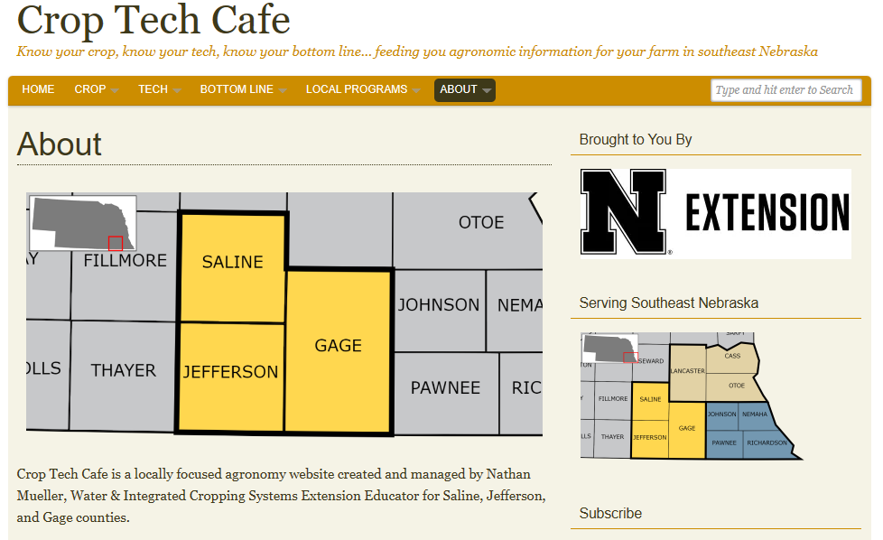
"Crop Tech Cafe is a locally focused agronomy website created and managed by Nathan Mueller, Water & Integrated Cropping Systems Extension Educator for Saline, Jefferson, and Gage counties.
Crop Tech Cafe provides locally relevant and timely information to crop producers in southeast Nebraska." Visit Crop Tech Cafe to learn more and stay up to date on local news and programs!

Following the annual review of fall groundwater level measurements at its monthly meeting on December 8, 2022, record low static water levels, new irrigation wells being permitted in areas of groundwater level decline and marginal aquifer areas, drought conditions, and the concern for the sustainability of groundwater supplies for domestic, livestock, and crop irrigation uses, the Board of Directors, as provided in Neb. Rev. Stat. § 46-707(2), proactively took action to impose an immediate 180-day moratorium, or stay, on the construction of new wells and increase of irrigated acres in the district. During the moratorium, the LBBNRD contracted engineering firm Olsson Inc. to study the different aquifer formations and establish subareas to provide a more specific approach to managing the variability of the aquifers throughout the district. Olsson also analyzed the criteria of the District’s high capacity well permit ranking calculator to manage development in diverse aquifer formations.
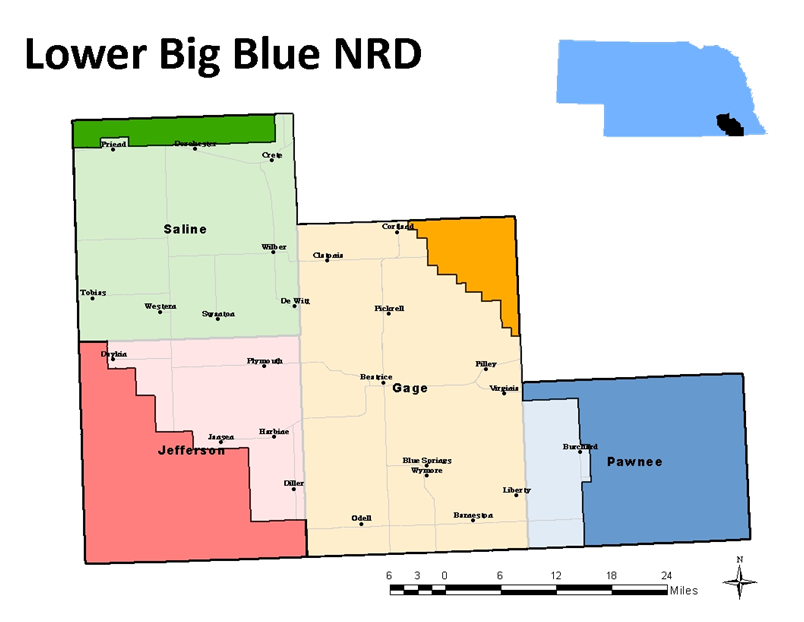
The Lower Big Blue NRD includes portions of Gage, Jefferson, Saline, and Pawnee Counties. In its effort to continue to conserve and protect the groundwater resources the Board of Directors took action to extend the district-wide moratorium on new wells and the expansion of historically irrigated acres. This comes after the NRD received public comment regarding the potential extension during a hearing held in DeWitt on May 18, 2023. The original 180-day moratorium was set to expire on June 6, 2023.
The primary reasons for extending the stay were the annual spring groundwater levels measured in April showing declines over the past 2 to 3 years, the continuing drought conditions, and the need for more time to discuss management options, review rules and regulations, evaluate the geology and aquifer characteristics of the district, and to establish subareas.
During this indefinite extension of the moratorium, NRD staff and directors will continue to work to better understand hydrogeology and evaluate effective, area-specific groundwater management options for the District. The District will also continue to work with producers to certify their current irrigated acres as has been a requirement since 2014. Please contact the NRD office to make sure your irrigated acres are certified and up to date.
Finally, it is the intent of the NRD to emerge from the district-wide moratorium with a comprehensive and diverse structure for managing the use of groundwater across variable aquifer formations and ensure that our most valuable resource is being used efficiently and effectively.


